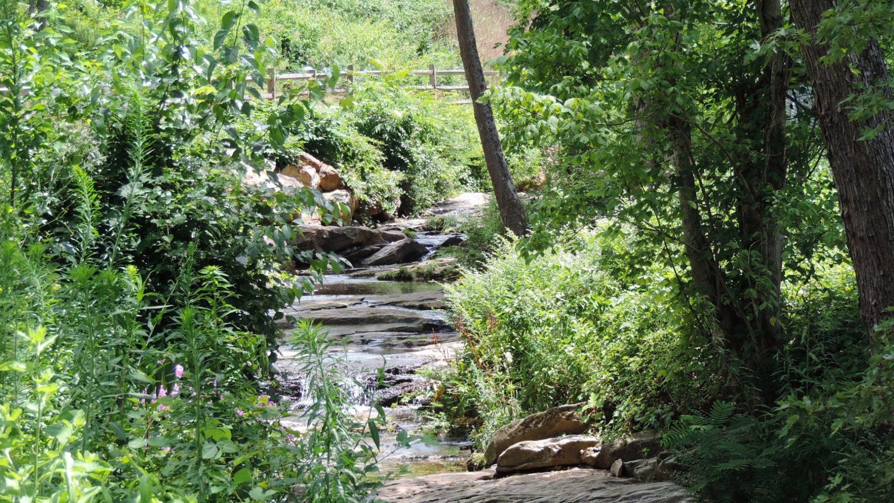
Greenways Last updated or reviewed on April 6, 2026 Greenways are shared-use paths that have been developed for both recreational and transportation uses. Greenways offer spaces separated and protected from motor vehicle traffic and are designed to be a low-stress facility for users of all ages and abilities to experience. The City of Asheville currently manages approximately 9 miles of greenway and continues to expand its greenway network with projects that will soon move into the construction phase. The following sections on this page contain additional information to resources that align with the greenway program provided within the City’s Transportation Department. Existing Greenways In Progress Greenways How Greenways Get Built Asheville’s Greenway Master Plan: The GAP Plan AVL Unpaved Greenway Etiquette Greenway User Surveys Additional Resources Get Involved Contact Information Existing Greenways The City currently maintains 6 different greenways totaling approximately 9 miles in length. More information about our existing greenways can be found in the table below. Greenway Approximate Length French Broad Greenway The French Broad Greenway is Asheville’s major north-south alternative transportation corridor. It begins at Hominy Park in West Asheville and travels the western banks of the French Broad River through Carrier Park and ends at Craven Street. 3.9 miles Wilma Dykeman Greenway (RADTIP) The Wilma Dykeman Greenway coincides with a major urban waterfront development project, the River Arts District Transportation Project. This section of the Greenway follows the eastern banks of the French Broad river from Hill Street to Amboy Road. A two-way cycle track parallels the greenway from Amboy Road northward for approximately 1 mile. 2.2 miles Glenn’s Creek Greenway The Glenn’s Creek Greenway extends westward from Weaver Park on Merrimon Avenue to Broadway St.. This paved trail connects the Norwood, Montford and University neighborhoods via mostly wooded and richly landscaped settings. The trail is on-road in portions but there are also off-road trails as well through Weaver Park and the park-like setting of the University of North Carolina – Asheville. The Reed Creek Greenway links into this greenway corridor at the intersection of W.T. Weaver Blvd. and Broadway St. .75 miles Reed Creek Greenway The Reed Creek Greenway begins at the Botanical Gardens on W.T. Weaver Boulevard, and runs parallel to Broadway Avenue towards downtown and bordering the Montford neighborhood. It’s situated along a creek and riparian terrain with a slightly urban feel due to the proximity of the development along portions of Broadway. .9 miles Swannanoa Greenway This section of the Swannanoa Greenway travels along the banks of the Swannanoa River in East Asheville inside River Bend Park. This section is accessible from the shopping center parking lot. 0.5 miles Hominy Creek Greenway The existing segment of this Greenway begins at 26 Shelburne Road and continues along the banks of Hominy Creek until it intersects with Sand Hill Road. This is a dirt trail where visitors can enjoy a quiet walk in nature. This trail is a natural-surface trail and is not paved. Visitors should be prepared for muddy spots after wet weather. .7 miles In Progress Greenways The City has a number of greenway projects that are in various stages of development. It often takes many years for the idea of a greenway to become reality on the ground. Complexity, funding, public support, and political will can all impact how long a greenway project can take from start to finish. Greenway projects begin long before any dirt is actually moved. Learn more about this process in the “How Greenways Get Built” section. In Progress Greenways Greenway Phase Map Greenway Connectors The Greenway Connectors are on-road improvements in two project areas for bike and pedestrian safety and wayfinding. The objective of this project is to connect greenways in the project area and provide safe passage for pedestrians and bicyclists from one greenway trailhead to another. This project is essentially two projects on each side of the future Nasty Branch Greenway located in the Southside neighborhood: From the eastern trailhead of the Nasty Branch Greenway on the corner of Phifer Street and McDowell Avenue through Southside Avenue, Short Coxe Avenue, Biltmore Avenue, and Buchanan Avenue, ending at the parking lot of Memorial Stadium. From the western trailhead of Nasty Branch Greenway on Depot Street just south of the Dr. Wesley Grant Center to the southern trailhead of the Bacoate Branch Greenway on Clingman Extension. An extension of the connector way-finding system will be applied from Depot Street to Riverside Drive on Lyman Street. Construction Swannanoa Greenway (Phase I) This section begins at the eastern end of Thompson Street at Glendale Rd. It will follow the river behind businesses along the Swannanoa River for approximately 1 mile and will terminate at the intersection of Bleachery Road and Swannanoa River Road. Construction began in 2024, but is currently on pause due to impacts to the project site from Hurricane Helene. Pending Construction Nasty Branch Greenway This project is a ¾-mile-long greenway that starts at the Grant Southside Center on Depot Street and Livingston Street and terminates at Phifer Street near the McDowell and Southside intersection. This greenway lies on flat terrain along the banks of the creek called Town Branch. This is an important East/West connection in the greenway network. This greenway will feature a series of interpretive signs about the devastating impact of the razing of the Southside Community, a historically African-American community, due to urban renewal. In the fall of 2020, the City of Asheville officially changed the name of this greenway from the Town Branch Greenway to the Nasty Branch Greenway to honor the microlocal name the Southside neighborhood calls the creek. The greenway will feature interpretive signs that tell the history of the Southside neighborhood before Urban Renewal raised most of the area. These signs will give more detail to the significance of the name Nasty Branch. Construction is expected to begin in 2025. Pending Construction Beaucatcher Greenway This greenway is a 1.25-mile-long greenway designed to connect Memorial Stadium to the historic (and reputedly haunted) Helen’s Bridge. This greenway will also have a spur trail to connect a future park, the White Fawn Overlook Park on the top of Beaucatcher Mountain off of Reservoir Road. Currently, the City is contemplating building the entire greenway to the finalized plans or modifying the construction to be able to build access sections at either end that enhance public access and safety and can be built with existing funds. Designed Wilma Dykeman Greenway Extension The City of Asheville received funding through the Surface Transportation Block Grant (STBG) program administered by the North Carolina Department of Transportation (NCDOT) to hire a consultant for design and engineering services that will expand the existing Wilma Dykeman Greenway approximately one mile from its existing northern terminus near Hill Street northward to Pearson Bridge Road. This segment of greenway will connect with the multi-use path to be constructed as part of NCDOT’s project #EB-5822 which will also ultimately connect with the Town of Woodfin Greenway. Preliminary Engineering & Design in progress Coming Soon! Reed Creek Greenway Extension This feasibility study was completed to determine the best alignments for extending the greenway to the north and the south. The northern section will be extended to the intersection of Broadway St and Riverside Dr, and the southern section will terminate at the I-26 pedestrian bridge on Hill St near Isaac Dickson Elementary. Following the feasibility study, design, engineering and right-of-way acquisition will need to occur before construction. Preliminary Engineering & Design for the northern section has begun West Asheville Greenway Part of NCDOT’s I-26 Connector Project. Coming Soon! How Greenways Get Built The life cycle of greenway project often moves through the following stages: Guiding Plan Development → Feasibility Study → Preliminary Engineering → Design → Right-of-Way Acquisition → Construction Guiding Plan Development: A master planning process or long-range planning process is often the very first step in identifying future greenway projects. This planning process is typically high-level, meaning it doesn’t delve into the finer details of exactly where the greenway would go or what it might look like. This planning process also often utilizes public input to identify community desires and priorities. Feasibility Study: Feasibility studies are an important next step in advancing a greenway project. These studies look at the physical and environmental constraints that might affect the construction of a greenway such as wetlands, endangered species habitats, floodways, contaminated properties (brownfields), utility locations, and railroad lines. Knowing this information early in the project development process provides a clearer picture of how complex design and construction might be, which also impacts how much construction might cost. The result of a feasibility study is the identification of (usually) several alternatives for the path that the greenway could travel, including the preferred alternative. Preliminary Engineering & Design: Often informed by a feasibility study, this stage involves activities such as location surveying, environmental documents and permitting, utility location, and ultimately, the specific route the greenway will follow. Preliminary engineering and design result in the preparation of plans, specifications, and more refined estimates prior to putting the project out to bid for construction. Property needs and the extent to which the project will need to encroach on private property are identified during this phase. Right-of-Way Acquisition: This phase can occur alongside preliminary engineering and design, or it can follow after. It does, however, occur before construction can take place. Right-of-way (ROW) acquisition is the process of obtaining land or easements to complete a project, such as constructing a greenway. ROW acquisition occurs when a project will need to permanently utilize space that currently exists on private property. Unless the private property or usage of the private property is donated, financial compensation is provided to the property owner in exchange for the ROW acquisition. Construction: The construction phase is when the physical development of the greenway occurs. Asheville’s Greenway Master Plan: The GAP Plan In October 2022, City Council adopted the GAP Plan which was produced through the Close the GAP Planning Process. This plan provides updates to the City’s Greenway Master Plan (G), ADA Transition Plan (A)*, and Pedestrian Master Plan (P) in one comprehensive document. These plans were combined because Asheville’s overall pedestrian network will be stronger if the three aspects – greenways, ADA accessibility, and pedestrian networks are considered and planned at the same time. The GAP Plan identifies greenway, accessibility, and pedestrian networks for our community as well as programs and policies to support the expansion of these networks. Just like a road transportation network, a greenway system can have different levels of service and characteristics based on how many people it will serve, if it is a local or regional connection, or if it has corridor constraints that define how wide the greenway can be. The GAP Plan identifies a new set of typologies to guide greenway planning and development in the City. In this plan, each greenway has been assigned a typology that defines the experience, width, easement requirements, and other design characteristics. For more information, go to the Close the GAP Page. AVL Unpaved The GAP Plan introduced a new greenway typology – natural surface trails – into the City’s greenway design standards. Natural surface trails are constructed out of materials such as dirt or stone rather than asphalt or concrete. AVL Unpaved is a community-supported initiative, led by Asheville on Bikes, Pisgah Area SORBA, and Connect Buncombe, dedicated to building a network of multi-use natural surface trails connecting Asheville-area residents and visitors with the natural environment and the city. Users will be able to access the trail system via greenway, sidewalks, bike lanes, and trailheads. These trails will connect to and expand Asheville’s existing multimodal transportation network. More about AVL Unpaved here. Greenway Etiquette Simply put, walkers and riders, including e-bikes, electric scooters, wheelchairs, and other devices such as one wheels, etc., are able to share the community space in a variety of ways. But just like any other multi-use community facility or asset, a little neighborly courtesy can go a long way and is expected amongst users. Judging by some of the complaints the City receives, remembering the “rules of the road” to be courteous and accommodating to other users can be difficult to remember when enjoying the space. Some “best practices” on the shared spaces of our greenway system, include: The cycle track in the River Arts District is intended for faster traffic like bikes and other devices. When passing, go slow, pass on the left, and announce your presence in advance. When using earbuds or headphones, listen at a volume that you can hear people announcing they are passing you. Travel no more than 2 people wide on the greenway. If stopping to gather or talk, get off the greenway so that you do not create an obstacle. Keep dogs (or any animals) on a 3′ leash. Do not litter. Greenway User Surveys A greenway user survey, or intercept survey, is a method of collecting data from greenway users by stopping and surveying them on-site to understand their demographics, usage patterns, motivations for using the path, as well as desired improvements. The City conducted greenway user surveys in 2021, during the Close the GAP (Greenway, ADA, Pedestrian) planning process. Since then, in 2024 and 2025, the surveys were conducted during the second week of September, the same week as the City’s annual Bicycle and Pedestrian Counts. Staff intends to continue these efforts moving forward on an annual basis as capacity allows. In 2021, the surveys occurred on the Wilma Dykeman Greenway. In 2024 and 2025, the surveys took place on both the Wilma Dykeman Greenway and Reed Creek Greenway. You can view the 2025 greenway user survey summary here. Get Involved The work of City staff is greatly supported by local volunteers. Here are a few ways to get involved: Volunteer for the annual bicycle and pedestrian counts or greenway user surveys (both completed every September). Join the Multimodal Transportation Commission, or submit public comment for the meeting. Join the Active Transportation Committee, or submit public comment for the meeting. Reach out about interning with the Transportation Department. Contact Information Lucy Crown, Transportation Planning Manager