Archived Project
As of 7/2/2026, this project is complete, and this page has been archived and is not being updated. It is retained and provided solely for reference, research, or recordkeeping purposes. It may contain information that is inaccurate and/or out of date. The City of Asheville (City) strives to ensure information on City websites is accessible. Our goal is to deliver a web experience that achieves “Level AA” conformance according to the Web Content Accessibility Guidelines v2.1 (WCAG 2.1). Some of the documents on this page may not be fully accessible per ADA guidelines.
If you encounter any accessibility barriers, please contact the Planning Department at planning@ashevillenc.gov to obtain an accessible version.”
About the Project
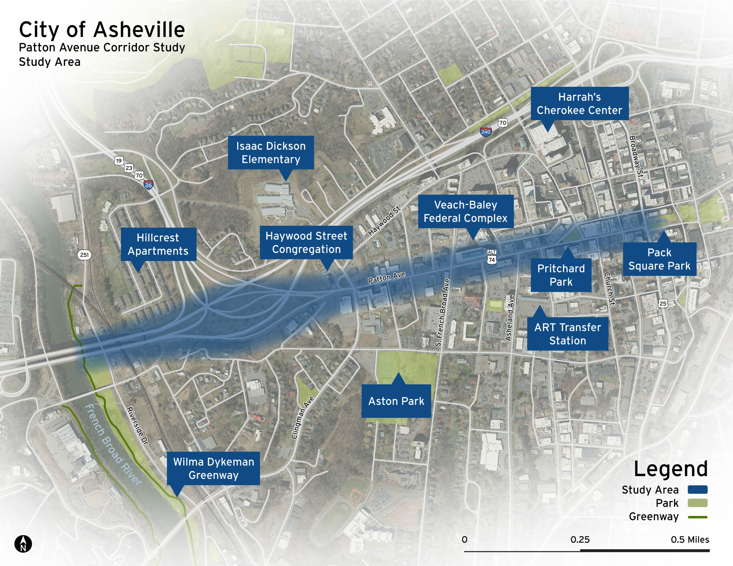
The purpose of the Patton Avenue Corridor Study is to develop transportation, land use, and urban design recommendations for Patton Avenue from the Jeff Bowen Bridge to the easternmost terminus at Pack Square. The goals for the study are to:
- Transform the area so that Patton Avenue and the Captain Jeff Bowen Bridges serves as a gateway to the Downtown;
- Set the stage for Patton Avenue to develop as a mixed-use corridor;
- Retrofit Patton Avenue into a complete street that is safe for all road users;
- Improve connections at Hillcrest to integrate this community with Downtown and terminate at Pack Square;
- Better connect Downtown to the river and other neighborhoods; and
- Create a plan for a network of multi-use paths that connect people to nearby economic and recreational opportunities.
Other City projects within the Downtown Patton Avenue Study area
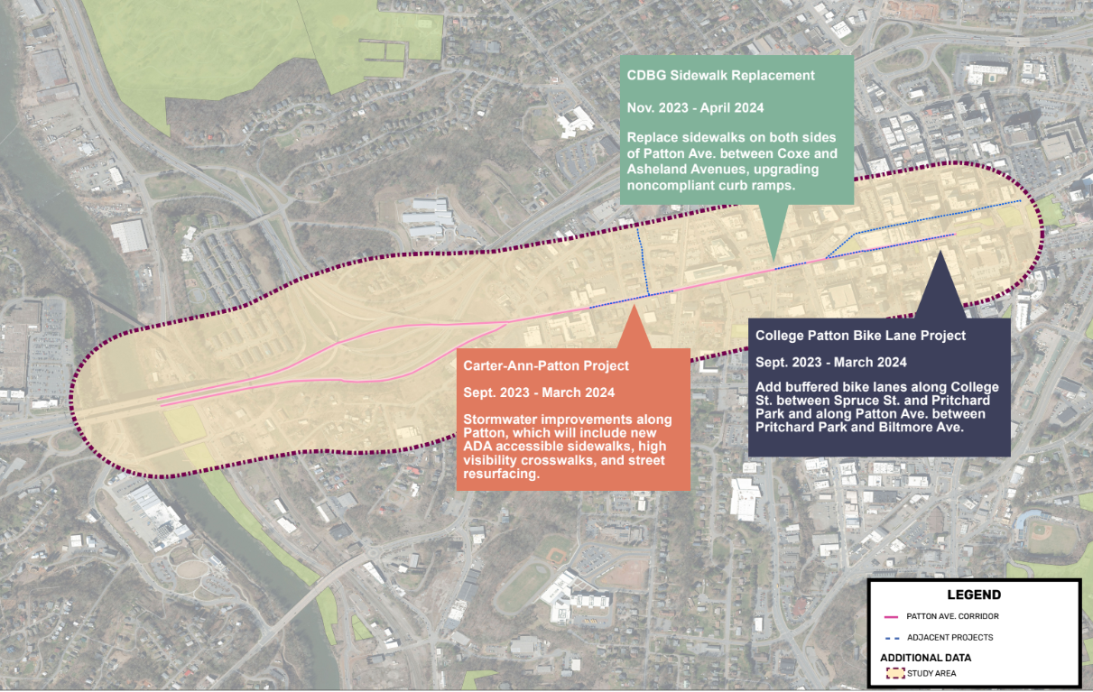
There are three other City projects within this same study area, as shown in the map below (click the map to expand it). To learn more about any of those projects, select the relevant hyperlink below.
Happening Now
Background
For decades residents have been trying to create a vision for the western gateway to downtown Asheville. Concepts focused on transportation changes, such as realigning Patton Avenue, as well as land use ideas to extend the downtown westward to the Jeff Bowen bridge. In 2022, staff summarized these efforts in the East Patton Avenue Report.
Timeline
August 22, 2023 – City Council authorizes a professional contract with McAdams
August 28, 2023 – Internal Kickoff Meeting with McAdams, NCDOT, the MPO, and City staff
November 29, 2023 – Public Open House (5-7PM, Banquet Hall, Harrah’s Cherokee Center, 87 Haywood St, Asheville, NC 28801)
May 29, 2024 – Public Open House #2 (5-7PM, Banquet Hall, Harrah’s Cherokee Center, 87 Haywood St, Asheville, NC 28801)
July 16, 2025 – The city releases the final Downtown Patton Avenue Corridor Feasibility Study.
Supporting Documents
Resolution No 23-174 Authorizing the City to Execute a Contract with McAdams
Poster Boards from November 29th Public Open House
Poster Boards from May 29th Public Open House #2
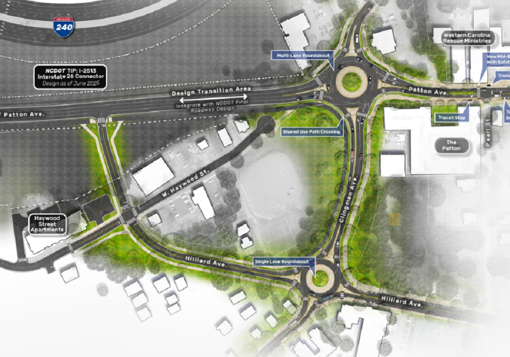
Proposed Patton Avenue Preliminary Conceptual Design (May 29, 2024)
Final Downtown Patton Avenue Corridor Feasibility Study
Final Downtown Patton Avenue Corridor Study (Full Spread Format)
Contact Information
PattonAvenueStudy@publicinput.com