This entry is part of Park Views, a weekly Asheville Parks & Recreation series that explores the history of the city’s public parks and community centers – and the mountain spirit that helped make them the unique spaces they are today. Read more from the series and follow APR on Facebook and Instagram for additional photos, upcoming events, and opportunities.
Parks and river walks along Asheville’s urban waterfront increase social equity, drive economic opportunities, and act as adaptable and sustainable infrastructure in the face of climate change. They enhance water quality, prevent flooding, improve air quality, provide vegetative buffers to development, maintain the urban tree canopy, and produce habitats for wildlife while allowing residents places to explore, connect, and discover close to home.
Azalea, Carrier, French Broad River, and Recreation parks may have more name recognition, but four smaller riverfront parks provide plenty of opportunities to stay active, enjoy the natural beauty of the city, improve mental health, and preserve the culture and spirit of the community.
A River Runs Through
 The French Broad and Swannanoa rivers have hosted recreation experiences for thousands of years. ᏙᎩᏯᏍᏗ (Togiyasdi, “the place where they race”) was the name given to the joining of the two rivers by the Cherokee people as they built towns and villages, complete with meeting plazas, hunting grounds, and courts for ball play along the riverbanks. Carrier’s Field and Riverside Park, two of Asheville’s earliest parks, were built on the riverfront in 1892 and 1904.
By the 1950s, population growth and river district industrialization turned the French Broad into an open sewer with floating garbage, landfill seepage, and chemical runoff, documented in Wilma Dykeman’s The French Broad. As the United States Bicentennial approached, interest in cleaning up the French Broad gained support. Buncombe County qualified for federal funds through the Public Works and Economic Development Act of 1965 to expedite the rehabilitation process because the river’s sad state was linked to economic distress and persistent unemployment.
Groups including Quality Forward (predecessor to Asheville GreenWorks) harnessed community members and equipment donated by local industries to clear the French Broad and Swannanoa rivers of numerous car bodies, tires, appliances, and other interesting debris. At the same time, Land of Sky Regional Council used a small grant from Tennessee Valley Authority (TVA) to prepare a riverfront development strategy to support short- and long-term goals.
In the late 1970s, only one riverside park had been developed for public use in Buncombe County, Sandy Bottoms-Bent Creek Park. The lack of public access to the river was a major problem for recreational canoeists, hunters, and people looking to fish. Often, they would find themselves trespassing on private lands to reach the water. Without trash bins and public parking, litter and vandalism was an unfortunate result.
The first French Broad River Recreation Access Plan debuted in 1977 with an emphasis on basic access sites, hiking trails, and public parks, along with streambank stabilization and erosion control. Since that time, Asheville Parks & Recreation (APR) has added large and small parks, greenways, and natural areas along the city’s waterfront.
Amboy Riverfront Park
 French Broad River Park was the first phase of a development plan that included Carrier and Amboy Riverfront parks and French Broad River Greenway. Its immediate popularity led to funds from the City of Asheville and grants from the Pigeon River Fund, North Carolina Department of Environmental Quality, and Federal Highway Administration to develop a nearby riverfront park that would be connected by a trail.
Featuring parking, river overlook and fishing deck, shaded lawn and wetland areas, benches, and a paved greenway that connects to larger parks, Amboy Riverfront Park is a favorite spot for locals looking to register some distance on the way to the nearby off-leash dog park, jump on the greenway, or watch boaters and tubers come down the river.
Craven Street Bridge Boating Access Area
 Until APR and North Carolina Wildlife Resources Commission opened the first public boat ramp in Asheville, public river access points were constructed as wooden or stone stairs – and none were built for the level of use seen today. While the ramp allows anglers and recreational boaters safer and easier access to the river, Craven Street Bridge BAA offers other unique features for those looking to stay on land.
Ample parking, benches, and access to Wilma Dykeman Greenway compliment a 12-foot tall public art sculpture. Local artist David Earl Tomlinson made “Big Fish” from recycled materials, bringing awareness to water quality programs such as Asheville GreenWorks’ Trash Trout™ waterway litter traps.
Jean Webb Park
 Asheville native Jean Webb served as Executive Director of Quality Forward from 1978 to 1983. These critical years set up a river rebound guided by her love of the French Broad and a hope that it could be the center of a clean, vibrant Asheville. Webb organized the community’s first river cleanup day guided by the belief that if people used and enjoyed the river, they would take care of it.
As president of French Broad River Foundation, Webb later helped organize Riverfest to support its mission, worked with City of Asheville and Buncombe County leaders to develop safe access to the river, and organized Streamwatch groups to monitor pollution. All these efforts began to make a difference and led to the formation of Riverlink.
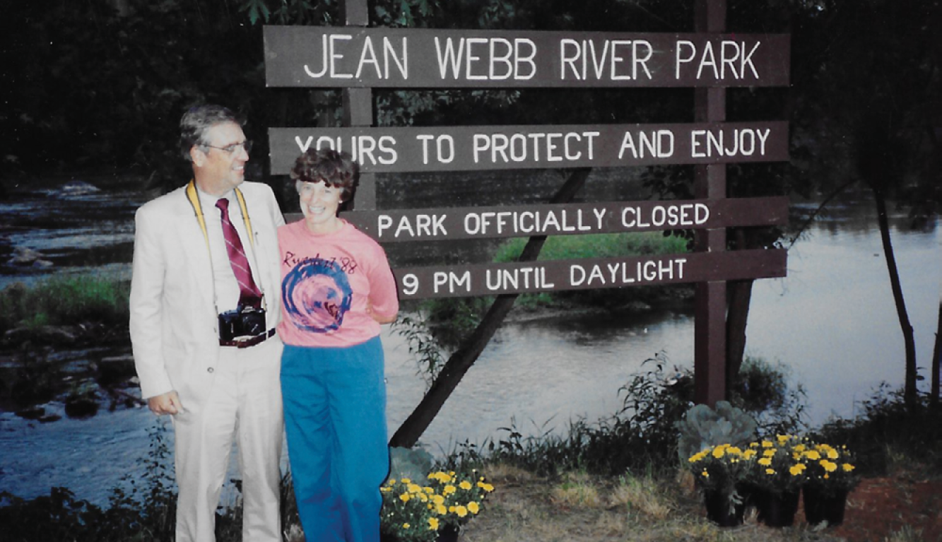
When Jean Webb Park was officially dedicated on August 31, 1988, it joined six other public river access parks managed by Buncombe County Parks & Recreation. It later became part of the APR system and received major upgrades during the development of Wilma Dykeman Greenway. New amenities include covered paved parking, accessible benches and water viewing areas, an educational pollinator garden, safer water access steps downstream from the parking area, picnic areas, public art, expanded lawn spaces, and public restrooms across Riverside Drive in 8 River Arts Place.
Riverbend Park
 Several waterways feed into the French Broad including the Swannanoa River, a major tributary. With headwaters in Black Mountain, the river is 22 miles long and meets the French Broad near Amboy Riverfront Park. Like the French Broad, the Swannanoa attracted both recreation and industry near its banks in the early 20th century.
Textile factory Sayles Biltmore Bleacheries opened in 1927 and went out of business in 1991. After attempts to convert the vacant buildings into a business park proved unsuccessful, Walmart opened its first supercenter in Asheville on the site. In order to mitigate runoff from the store’s massive parking lot, developers agreed to create a park out of 11 acres along the river and donate it to the City of Asheville.
Riverbend Park includes a completed section of Swannanoa Greenway, benches and picnic tables, and the original iron gates and some industrial equipment from the bleachery repurposed as public art. When the park was accepted into the APR system, it was dedicated to the memory of Sgt. Jeff Hewitt, a Marine Corps veteran and Buncombe County Sheriff’s Office deputy killed in the line of duty.
For more on the history of the French Broad River in Asheville, read Park Views: Wilma Dykeman Greenway. Black Mountain, Buncombe County, and Woodfin also maintain public riverfront parks in Buncombe County.
Do you have photos or stories to share about Asheville’s river front parks? Please send them to cbubenik@ashevillenc.gov so APR can be inspired by the past as we plan our future.
Photo and Image Credits
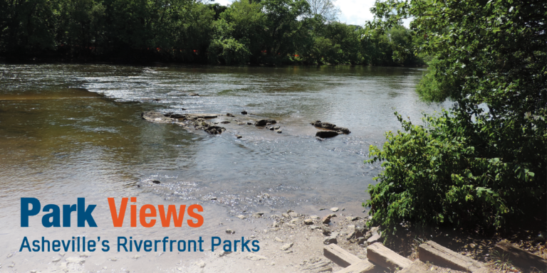
- The entirety of the French Broad in North Carolina is contained in Transylvania, Henderson, Buncombe, and Madison counties. Its headwaters are in Rosman and it joins with Holston River to form Tennessee River near Knoxville. This view from Jean Webb Park shows an unusually low water level.
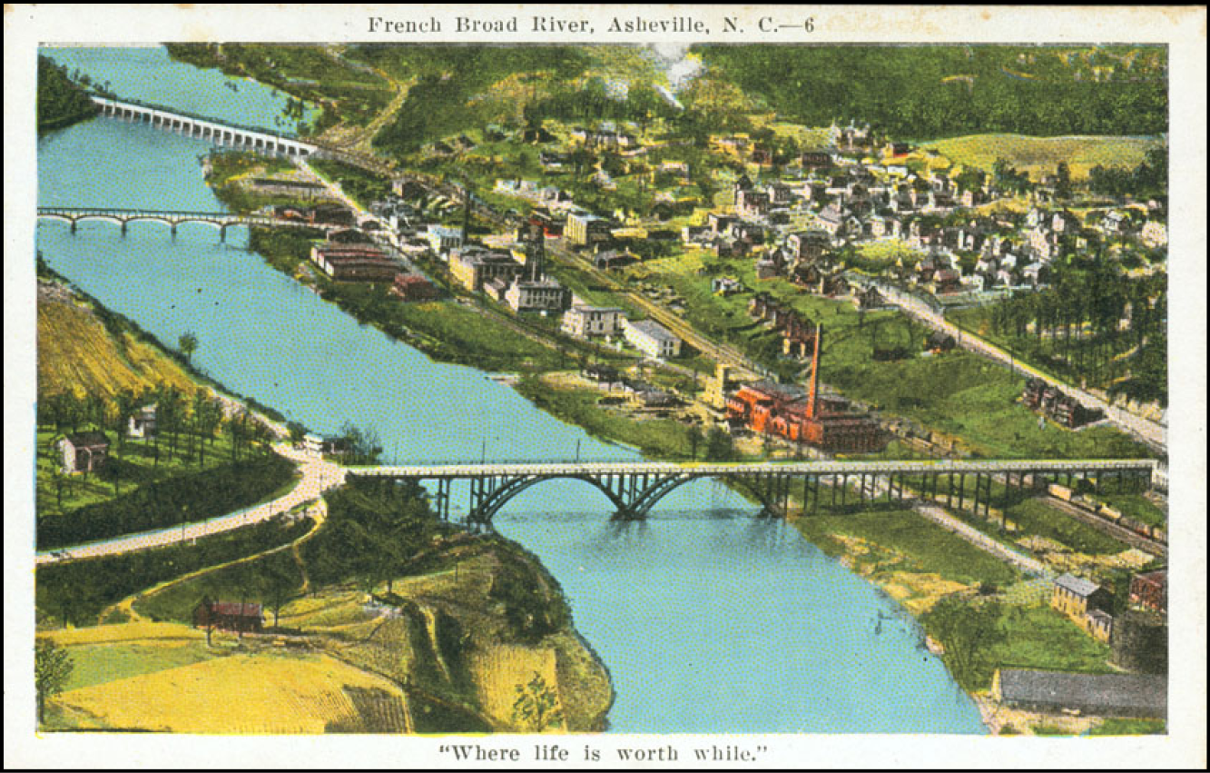
- An aerial view of French Broad River (c. 1917-1930) shows the old West Asheville Bridge in the foreground with Smith Bridge and Southern Railway Bridge in the background. Craven Street Bridge BAA is south of Smith Bridge. Jean Webb Park is located north, south, and under the old West Asheville Bridge and the iconic chimney from an ice house can still be seen across Riverside Drive. Courtesy of Buncombe County Special Collections, Pack Memorial Public Library, Asheville, North Carolina.
- Amboy Riverfront is a great spot for a picnic, kite flying, or tossing a frisbee. It is located about halfway between French Broad River Greenway’s trailheads at Hominy Creek River Park and the Craven Street-Emma Road intersection, making it a great resting area for those on an out-and-back journey.
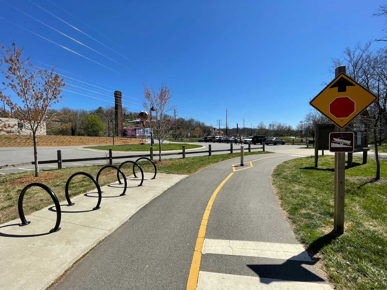
- An example that small parks can pack a big punch, Craven Street Bridge BAA’s floating dock and boat ramp allow an up-close look at the French Broad with views of New Belgium Brewery and River Arts District industrial architecture.
- Jean Williamson Webb was all smiles when her namesake park opened – and with good reason. The park represented more than a decade of organizing to restore the French Broad to its former glory. She once said, “I am committed to this community. I just hope that people will realize the value of the beauty around us.” Her work, hope, and commitment transformed not only the river, but Asheville. Courtesy of Laura Webb.
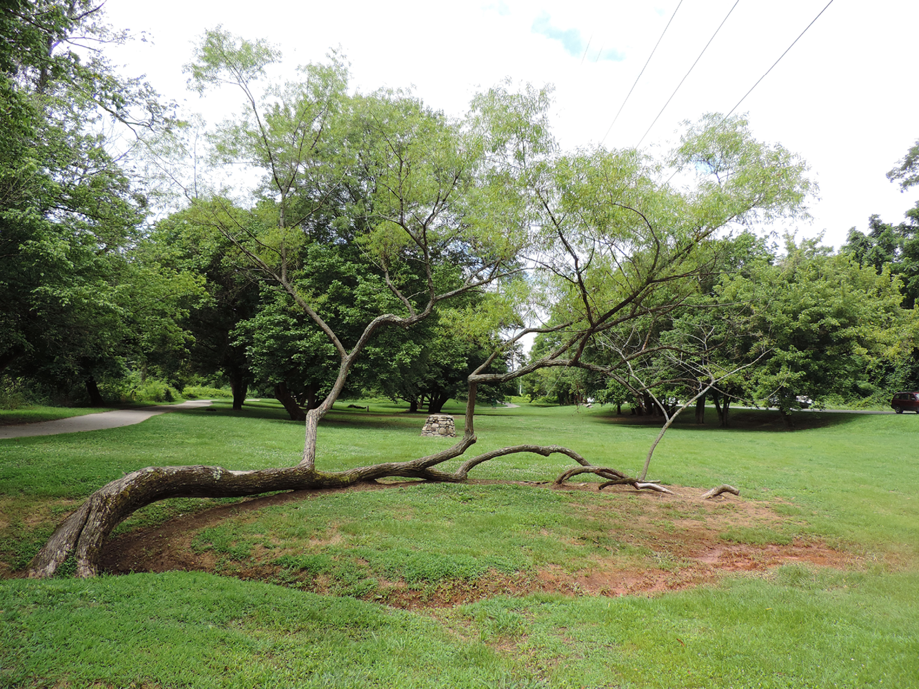
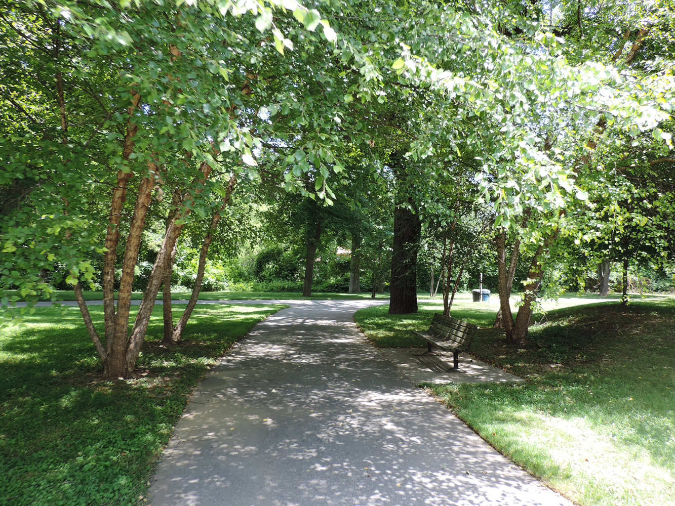
- Literally a place to connect with nature just steps away from “big box” retailers, Riverbend Park has plenty of open areas, mature trees, and a completed section of greenway will soon receive an extension to Thompson Street at Glendale Road. For more information, check out the GAP Plan.