Skip to content
The City of Asheville
  • Services
    • Apply for a job
    • Bikes, buses and cars
    • Business and self-employment
    • Business Inclusion/MWBE services
    • Children, family and pets
    • Commercial property and permits
    • Online Services
    • Parks, recreation and greenways
    • Pay a fee, ticket or fine
    • Report a crime, concern or nuisance
    • Residential property and permits
    • Safety and emergency preparedness
    • Trash, recycling and city upkeep
    • Water and utilities
    • Services directory
  • Departments
    • Contact Information
    • Capital Management
    • City Clerk
    • City Manager’s Office
    • Communication & Public Engagement
    • Community & Economic Development
    • Community & Regional Entertainment
    • Development Services
    • Equity and Inclusion
    • Finance and Management Services
    • Fire
    • Harrah’s Cherokee Center – Asheville
    • Human Resources
    • Internal Audit
    • IT Services
    • Legal
    • Parking Services
    • Asheville Parks & Recreation
    • Police
    • Planning and Urban Design
    • Public Works
    • Purchasing
    • Sanitation
    • Stormwater Services and Utility
    • Street Services
    • Sustainability
    • Transit
    • Transportation
    • Water
  • Projects
  • Government
  • Engage
  • News
  • Search Search
Home / News / City of Asheville launches interactive neighborhood map

City of Asheville launches interactive neighborhood map

Posted on March 21, 2017October 4, 2019 by Web Editors - CAPE

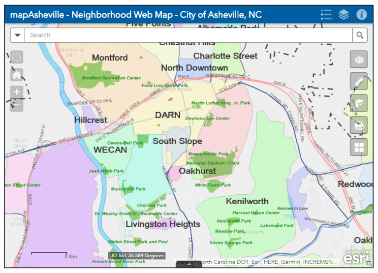
Neighborhoods are a vital part of every community. Every day people visit Asheville for the views, culture and atmosphere, but they relocate here because of our amazing and unique neighborhoods! The City of Asheville is excited to share a new neighborhood mapping tool. The interactive web map will assist both prospective and current residents with connecting to neighborhoods and foster collaboration between existing neighborhood groups.  

As the City has grown over the past several years, more and more neighborhoods have become active, and began organizing to ensure their voices are heard in City Hall. The interactive neighborhood map outlines neighborhood boundaries and allows the user to view the neighborhood’s primary contact. Additionally, the interactive map contains neighborhood information such as website and social media sites.

This tool is a work in progress and the City is looking for citizen  assistance to help keep the information up-to-date. Existing groups are encouraged to view their current information on the tool and provide any updates to Interim Neighborhood Services Coordinator, Ashley Traynum-Carson.

The map is limited to neighborhoods who have an active and established neighborhood, homeowner or resident association. Organized neighborhoods that are not reflected on the map can establish a presence by registering their neighborhood association with the City and providing a map of their boundaries. To learn more about the benefits of registering your neighborhood, click here.

For additional information on the interactive neighborhood map or registering a neighborhood contact Ashley Traynum-Carson at atraynum-carson@ashevillenc.gov or (828) 259-5506.

PostNewsCommunication and Public EngagementInteractive Neighborhood MapNeighborhood MapNeighborhood Services
The City of Asheville Dome
The City of Asheville 70 Court Plaza
P.O. Box 7148
Asheville, NC 28802
828-251-1122
Website Manager
Contact Us
Follow Us
  • Facebook
  • Twitter
  • Break
  • Instagram
  • YouTube
Stay in the loop

Sign up for our newsletter!

  • Home
  • Contact Us
  • Privacy Policy
  • Accessibility